
Immigration Routes
Based on the information in Chinese Exclusion Files, the first map shows the early Chinese immigration routes to the U.S. According to the data, during the Chinese Exclusion period, most of the Chinese immigrants came from Guangdong (Canton) province and settled down in the surrounding states of California, not California itself, and the East Coast. This is very different from the current reality where California holds the largest Asian population in the U.S. The reason behind this is probably California was the main state that pushed for the passage of Chinese Exclusion Act and opposed Chinese workers. The second map is mobile and gives the information of individual immigrants.
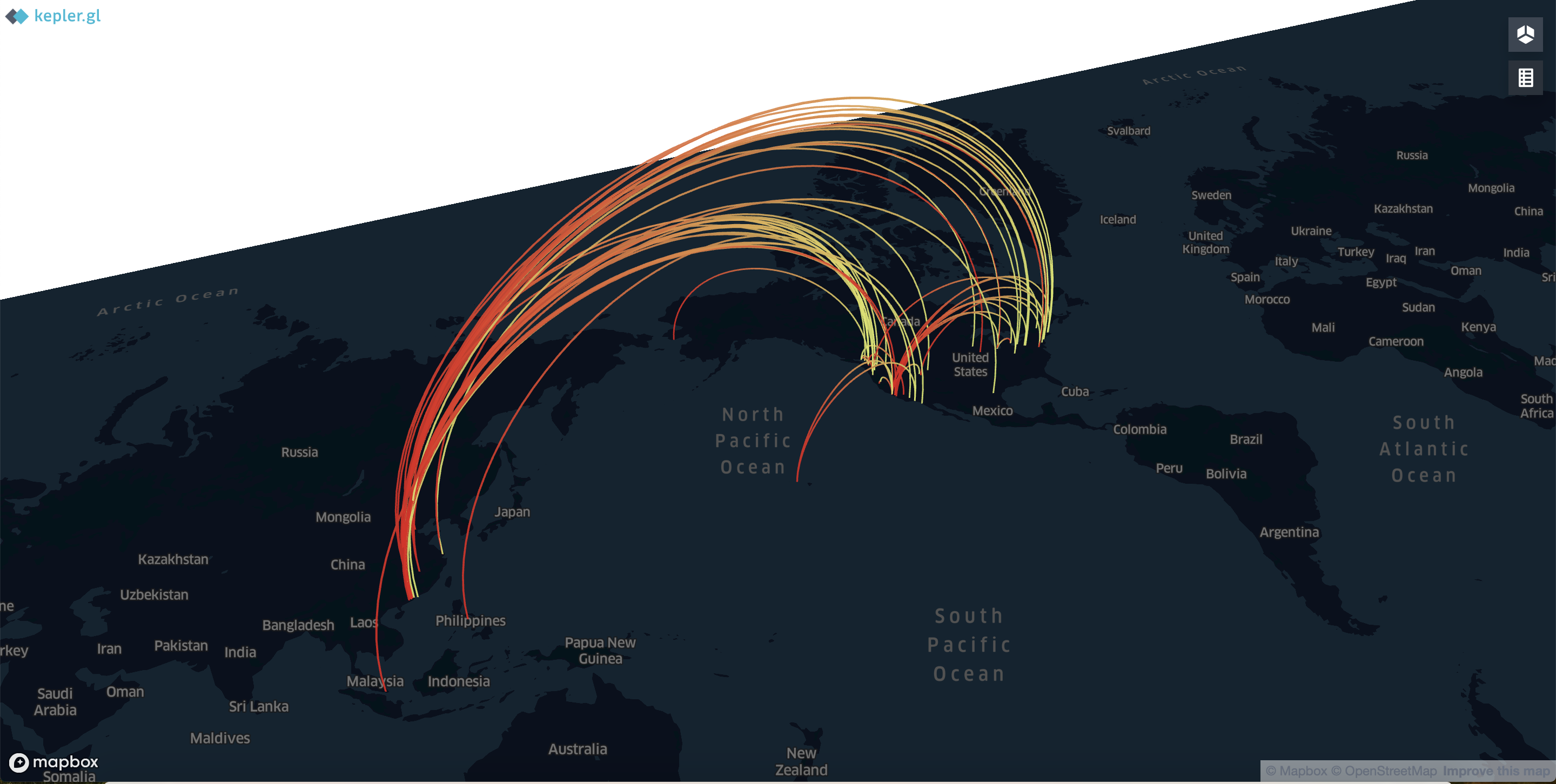
The link below is the original mapping of early Chinese immigrants. One string gives the information of immigrant. Please move China and America to the center of the map, zoom to the proper size, leave the arrow on each string. The information box will pop up.